Planning a canoe trip in "uncharted waters" and of several days duration, with additional canoeist having little or no experience, is a rather daunting task, particularly when the segment of river that is to be canoed is 1,250 miles from home. It requires a great deal of logistics planning.
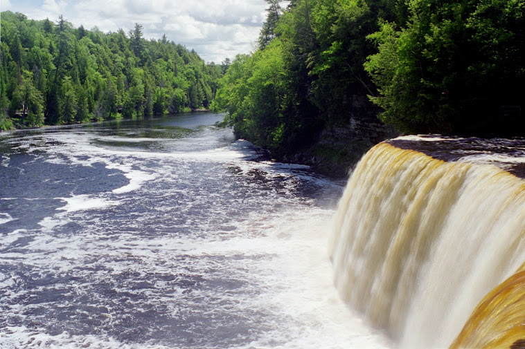
So it was with the 2009 trip on the Saint Joseph River from South Bend Indiana into Lake Michigan and up on the beach at Tiscornia Park in Michigan.
The planning of the trip began in earnest in the fall of 2008, using a variety of resources, some found on Google searches and others by sending out emails to people in the area where the trip was to take place. All were extremely helpful, some will be mentioned by name because the names are remembered but many were involved.
First a series of maps had to be obtained covering the entire route, maps with as much detail as possible. However a number of considerations had to be taken; a) paper doesn't do really well if it gets wet. b) and since one is only interested in the sections of the river to be canoed, not really the many miles of adjacent land and roads, the Indiana and Michigan Gazeeter were eliminated although they were recommended, and of course they are made out of paper. The solution then was to download Google Earth and to print satellite photo map sections of the river in 81/2 x 10 inch page formats, having these pages laminated (to keep the paper dry and keep the ink from running). This was done and the pages placed in a three ring binder.
Second, camp sites had to be found and not knowing if Indiana and Michigan laws regarding river banks were similar to Texas laws it was deemed prudent to use either islands (we later learned that islands in the river can be privately owned, which is not the case in Texas if the river is deemed navigable) and / or regular campgrounds along the way and two such campgrounds were found and contacted; Nub Lake Campground in Niles, just a short distance downstream on the right side of the river from the Niles Dam but unfortunately also up a short distance on the Dowagiac River from its junction with the Saint Joe and this proved to be a problem during the trip (1701 Pucker Street, Niles 269-687-9681) and Shamrock Park Campground, which is less than 1/2 mile from the downstream side of the Berrien Springs Dam on river right, and immediately adjacent to the river (9385 Old US 31 Berrien Springs, MI 269-473-5691. Tenative reservations were made at both of these campgrounds with the option of flexible days. This only left one campsite to be determined, a place somewhere on the half way point between Berrien Springs and Saint Joseph / Benton Harbor on the shores of Lake Michigan but none were found adjacent to the river. The solution then was to contact local police departments and city / township folk for additional information regarding possible camping spots that would not upset people or cause us to trespass on private lands; Chief Bill Marx of the Buchanan Police Department was extremely helpful, he even offered to let us use a piece of land owned by the Fraternal Order of Police adjacent to the river. As it turned out we did not need to use this campsite, but at the time it was a nice Ace in the hole.
Third, resupply points had to be determined. This was relatively easy as there are towns on the river and adjacent to the three dams that had to be portaged. So google searches were made for grocery stores in each of the towns; Niles, Buchanan and Berrien Springs. Stores located close to the dams were then selected and in order to be sure we didn't have old outdated information phone calls were made to each store a few days before the trip commenced, to make sure they were still in business.
Fourth, since one had no experience on that river except the segment from Bristol to Elkhart the previous year it seemed like a good idea to contact people that canoed the river on a regular basis all along the section we planned to canoe because of questions like; a) what are the water flow rates, and considering two heavily laden canoes how much progress should we expect in a day? b) Should the three dams be portaged river right or left? c) are the portages out and in clearly marked?, d) how long and / or difficult are the portages? As it turned out because of the information provided by the group listed below, we purchased a "dolly" by which to help move the canoes and the gear, but this of course added to the stuff in the canoes (see sixth below) e) are the dams clearly marked with barrier bouyes (it would be rather embarrasing to go over the edge of dam, not to mention hazardous to one's health), Where could one expect fast water flow and slow water flow, f) what other hazards might be present and so on in that line of questions. So once again google searches were made and a most helpful group of people was found, I will not mention each by name but many responded to my emails with helpful suggestions and valuable information, in particular;
michianacanoeguysandgals@gmail.com and they have a website / blog of which I can only find one of the members as I write this; paddleresources.blogspot.com My most sincere thanks to this group for all their help.
Fifth, since there would be six people canoeing requiring at least two canoes, I have one - the Pelican Bayou which of course is not a "true" canoe, another had to be either rented from a local livery or one had to be purchased. We did a lot of research and found that as a general rule similar canoes were about 15 to 18 % cheaper in this area of Texas than in Indiana / Michigan and that when the numbers were compared five days of rental would just about equal the cost of the second canoe, it was decided purchase the additional canoe and transport it with us to Indiana.
Sixth, as we were 2 adults and 4 children ranging in age from 10 to 16 - it was determined that two tents would suffice, one for the adults and one for the children. Everybody had their own sleeping bag.
Seventh, and perhaps the most crucial of the planning, since there were going to be one adult and two teenagers in each canoe how much stuff did we really need or want to carry, but this had to be viewed based on the following criteria - Although we might end up looking and smelling like barbarians, we were not going to eat like barbarians, we would have proper meals - We would avoid to the best of our ability Spam and similar type products and for that matter most canned stuff? Tents (2), sleeping bags (6), sleeping mats (2) for the adults - comfort is important. Ice chests for food (2) with one in each canoe. Dry provisions box (1) including vegetables (potatoes, carrots, onions, garlic, coffee, sugar, coffee, etc.), another dry box for cooking utensils, pots, pans, toilet tissue, etc.. Water, one 5 gallon collapsible plastic "tank". Personal clothing, one small back pack each including personal toiletries, medications, reading materials. Nothing that required batteries except two cell phones and a hand crank charge weather radio (which turned out to be more of a headache than a help) was to be allowed. Campstove and propane containers sufficient for a minimum of three meals a day for four days, as well as a lantern requiring propane. Fire wood starter, one ax, one machete, life jackets, canteens, one small collapsible shovel (entrenching tool for those of you of US Army background). We were told that the good people at the Coast Guard station in Saint Joe loved to see the orange of a life jacket being worn by the occupants of really small "vessels", in particular since the plan was, weather and sea conditions permitting, to head out into Lake Michigan and go around the North Jetty / Breakwater and to come up on the beach at Tiscornia Park.
As you can see, the canoes were quickly filling up. In order to obtain the best possible distribution of weight and space I loaded the canoes while they were sitting in my backyard here in Houston, and kept re-arranging until the best possible use of space was achieved and we kept this distribution on the trip.
Finally all the planning is done and all one has to do now is to wait for the months of June / July 2009 to begin the drive North, away from the Texas gulf coast heat and humidity.
My next post will be details of the trip itself.