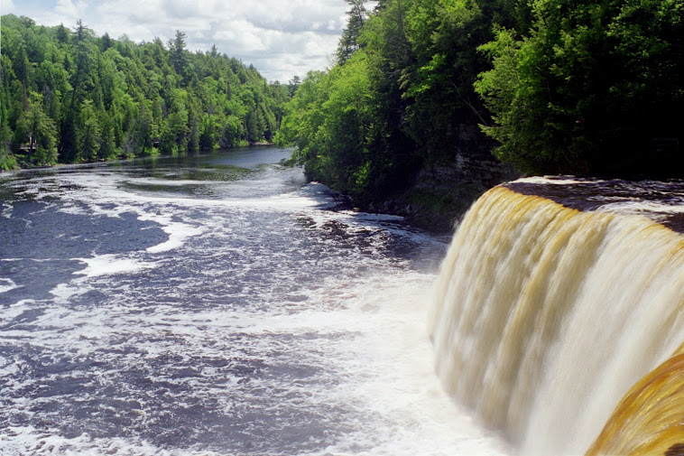
Since we have all day to complete this excursion we have leisurely drive across the Limfjord (Limfjorden)
onto what is now the island of Vendsyssel, which was not at first an island but is now because of a North Sea storm in 1825.
http://en.wikipedia.org/wiki/Limfjord
http://en.wikipedia.org/wiki/Aalborg
http://www.factbites.com/topics/Limfjord
Somewhere along the way we encounter an un-excavated viking grave, and there are several of these in that part of the country.

We drive along fertile farmland and then the landscape changes to sand dunes. It is a really nice tour. Our first real stop is the small village of Klitmøller
http://en.wikipedia.org/wiki/Klitm%C3%B8ller
http://www.surf-forecast.com/breaks/Klitmoller
http://www.landezine.com/index.php/2012/11/klitmoller-the-good-life-at-the-sea-by-preben-skaarup-landscape/
This is a live webcam link and as I write this in May 2014 there appears to be quite a bit of fog. http://www.waves4you.com/index.html
Here are a few photos from that interesting stop.
 |
| A commercial fishing boat on the hard. This one is now a sort of museum piece and there is a sign with its history but I do not remember the history. |
 |
| As you can see from our dress it is a typical Danish summer day. |
 |
| Norma on deck trying to be out of the wind. |
 |
| The fish boxes stacked on deck. |
 |
| It is a bit stormy out here so "one hand for the ship and one hand for me". |
 |
| These old wooden fishing boat have a lot of character. See the Hundested controllable pitch propeller. |
 |
| It would appear that people are still enjoying fishing based on all the boats up on the beach. |
The next stop is the town of Hanstholm, a fishing community on the western end of what is called Jammerbugten (the bay of wailing) as of the result of the many ship wrecks that occured here over the centuries during fierce storms.
http://en.wikipedia.org/wiki/Hanstholm
http://aroundguides.com/Hanstholm
http://www.maplandia.com/denmark/viborg/hanstholm/hanstholm/
http://venturedenmark.com/jutland/visitjammerbugten#.U3YwMyxOWM8
We still had quite a way to go to Skagen and a few more stops along the way we didn't spend much time in Hanstholm but here is a photo or two.
 |
| A glimse of the town which is based on commercial fishing. |
 |
| The port. |
 |
| A view of the big fishing trawlers. |
Now we are off to the church which is buried in the wandering sand dunes.
http://www.kulturarv.dk/1001fortaellinger/en_GB/the-sand-covered-church
http://en.wikipedia.org/wiki/The_Sand-Covered_Church
http://www.trekearth.com/gallery/Europe/Denmark/West/Nordjylland/Skagen/photo58447.htm
This is a very interesting site. The sand dunes "wander" depending on wind but have been "tamed" somewhat by growing a heather like vegetation with a good root system.
Here are our photos from that location and I will let the photos speak for themselves.


Then it is off to Skagen, the tip of the country and the tip of the Jylland (Jutland) peninsula.
http://en.wikipedia.org/wiki/Skagen
http://www.mapquest.com/maps?city=skagen&country=DK
First we had lunch at a little restaurant but there are no photos.
As for Skagen itself I will let the photos speak for themselves except to note that an interesting phenomena occurs here. Waves from the North Sea and the Skagerak meet waves coming from the Kattegat. The undertow is one of the strongest in this part of the world.
 |
| The "end of the world" or Lands end. At least it is not a sudden drop off. The Skagerak on the left and the Kattegat on the right and they kind of meet in the middle. |
 |
| The waves are coming from both sides. A ship is passing in the distance. |
 |
| If I keep going this way Denmark will become drier and wider. |
 |
| Norma looking back to where there is more land. |
 |
| Another ship passing to the North. |
 |
| Dry land ahead and another ship in the background. |
 |
| A nice young couple from Poland took our picture. One of the few pictures where we are together. There is one more ship on the horizon and it is a busy place. |
http://video.denmark.dk/video/4292659/skagen-light-paint-and
I think it is worth noting that these photos were taken in the month of July, at the height of summer on the "grenen", or translated "the branch", http://en.wikipedia.org/wiki/Grenen
http://www.bing.com/images/search?q=grenen&qpvt=grenen&FORM=IGRE
http://www.tripadvisor.com/Attraction_Review-g285705-d547796-Reviews-Grenen_Skagen-Skagen_Frederikshavn_Municipality_North_Jutland_Jutland.html
After we headed to the town of Skagen which is a fishing community.
http://en.wikipedia.org/wiki/Skagen
http://www.skagenhavn.dk/en/welcome_til_the_port_of_skagen.htm
http://www.toppenafdanmark.com/ln-int/north-jutland/welcome-skagen on the link at left there are several photos and on one you will see a ferry, yes, it is a ferry, not a passenger vessel.
http://www.bing.com/images/search?q=skagen+havn&qpvt=skagen+havn&FORM=IGRE
https://marinas.com/view/marina/11742_Skagen_Havn%2C_Fiskehuskajen__Denmark
While in Skagen we s hot a few photos and they are below.
 |
| This is not a photo of Norma, it is a photo of the lighthouse which used to be an old "vippe fyr". See explanation below. |
 |
| An "old" World War II bunker built by the Germans during their occupation of Denmark. |
 |
| Norma taking a break on the stone jetty. |
 |
| A close up of the lighthouse. |
 |
| A fishing trawler in port. |
 |
| A typical Danish North Sea trawler of years past, in the proper color. |
 |
| Norma enjoying a bit of sunshine. |
Here is a link to the Vippe Fyr. (The light that can be tilted)
http://www.skagen-tourist.dk/denmark/vippefyret-gdk642658
I have taken the liberty of translating the page as it is in Danish.
"It was Denmarks first Vippe Fyr built in 1627 and features an open burn basket.
The many shipwrecks by Skagen branch was the cause of a shuttle to the lighthouse was built. The lighthouse was supposed to help lead shipping free of the branch and the dangerous reefs out there.
The principle is simple, it lashes curve down to the ground, fill it with combustible material and turn up when fired, it can be tilted up burning basket can be seen from a long distance.
Tilting fired lights were in use well into the 18th century. The last Danish vippefyr was decommissioned at Anholt in 1788. Tilting lighthouse in Skagen is a 100% faithful copy of the old vippefyr-
reconstructed for the first time by Carl Locher in 1913 on the occasion of Skagen town's 500 year anniversary. Latest reconstruction is from 1958 made under the assistance of Rotary Skagen."
Then it was time to call it the day and head back to Nr. Nissum but along the way we had to stop and take two photos of a fantastic sunset, about 11:00 PM.
 |
| Looking West across the Limfjord with the bridge. |
 |
| Looking West. |